MT. KEATS


Grid Reference -32.920084, 116.129316 (GDA)
Department DEC
Work Centre ?
District Perth Hills
Grading ?
Elevation (ASL) 478m
Height 12m
Construction Timber
Cabin size ?
Public access to site No
In use since 1934 - 1970
Photo (1954-55) was supplied by Judith Halliday in March 2021. The original photo has been cropped to delete some sky and access road.

Tower was demolished in 1970.

Please click on thumbnails for enlargements
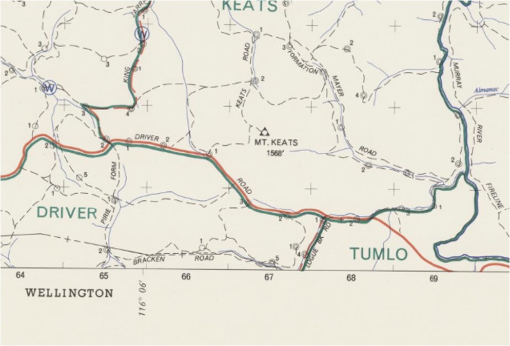
Screenshot of old map supplied by MLC in late 2019.
MLC also reported: Co-ordinates approx.
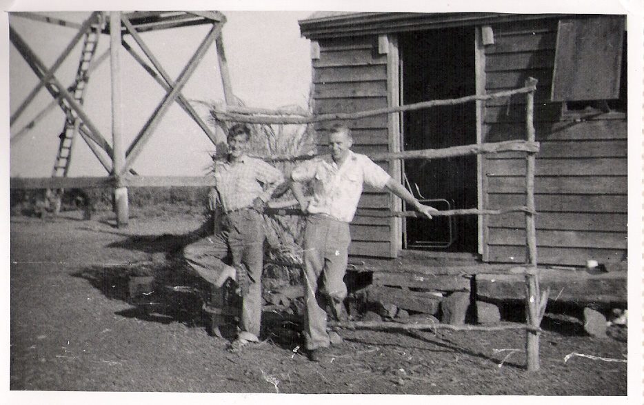
Photo supplied by Marion Lofthouse of the 'Memories of Harvey'
FaceBook site and used with permission.
The caption on the Facebook site reads: The fire lookout tower at Mt Keats.
In the photo are Jim Martin and Bob Hall. Photo courtesy Bob Hall

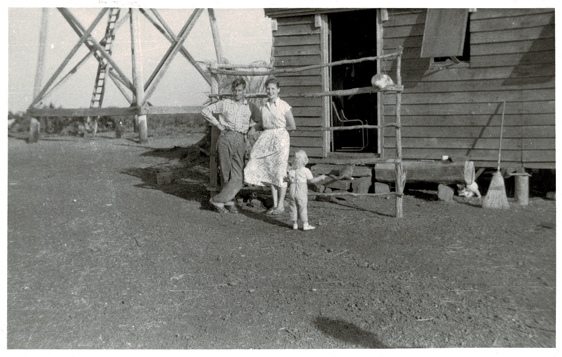
Another photo supplied by Judith Halliday in March 2021. Although simmilar to the photo with Jim and Bob, this photo shows that it was not only the FLO (Fire Lookout Observer) who stayed on site. Judith confirms this by stating: Mt. Keats Tower is where my Uncle worked for about 18 months around 1954-1955. He was James (Jim) Martin and his wife Ann also stayed with him.

The following quote is from an article in The Western Australian from Wednesday 5th Mar 1935, page 16:
During the past 12 months the scope of fire detection throughout the forest areas of the South-West had been extended by the erection of four additional fire towers, one near Sawyer's Valley, one at Teesdale (near Dwellingup), one on Mt. Keats and one on Mt. William, in the Yarloop area.

In Oct 2020, we got in touch with Alcoa to find out if access to Mt. Keats was possible as the area is currently mined by Alcoa. Scott Hansen, Community Relations & Communications for Alcoa replied and has been very helpful since. Because of the mining activity, the area is current a No-Go zone to the public but Scott offered to visit the site to see what was left of the tower. Scott supplied the 8 photos below and here follows an edited version of his findings.
"There is an overgrown track leading up to the summit, which opens up on a cleared area (3rd & 4th photo). No evidence of a comms hut or other buildings, or plinths that tower legs may have been fastened to, but we reckon we found what MAY be the remains of the wooden legs of the tower. The 8th and 6th Photo are what we reckon are these burnt remains: the 8th in particular shows remains of what we think may have been a leg, and you can see how it could have fallen. You see some pieces in the foreground and a couple of others laid out such that you could assume it was a long piece of timber that burnt and fell down. Like the 6th photo, we found 4 of these piles of rocks, each had these burnt timbers laying over nearby, as if the legs were placed directly into the ground and then these rocks were piled around the base of the legs as support. The configuration of the 4 piles of rocks in relation to the highest point of the mountain are such that it made sense to us that they were the bases of the legs. 5th & 7th photo: these large bolts were nearby to the burnt timbers, leading us to assume they may have been part of the fastening/bracing system of the tower structure. 1st and 2nd photos are of the survey marker and the DOLA sign."
Many thanks to Scott for this comprehensive report of the current situation on Mt. Keats.

Please click on thumbnails for enlargements


Back to Swan Region
Back to Western Australia Towers
Back to Home Page