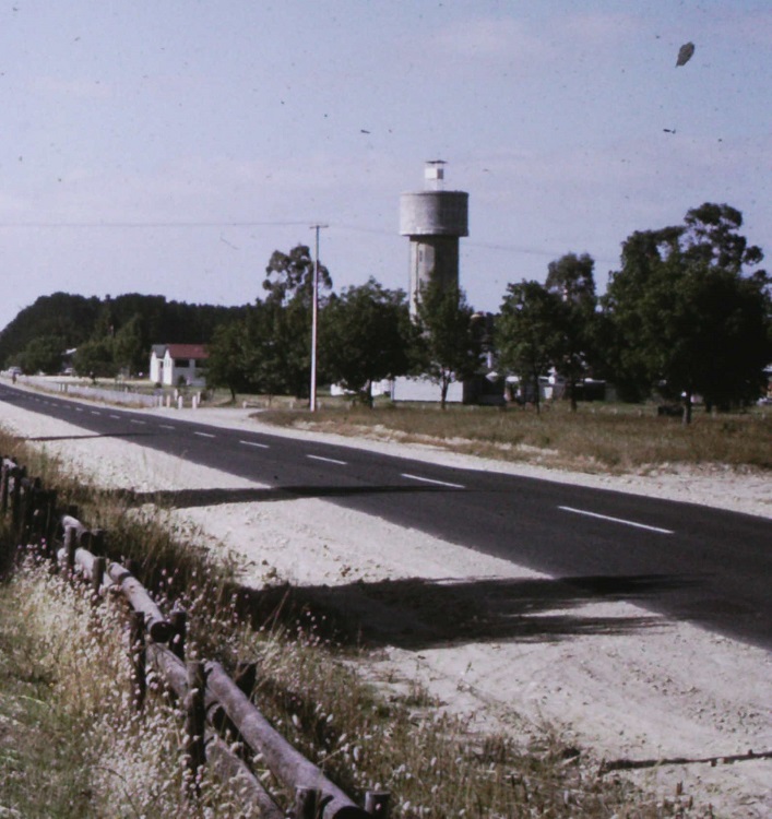
NANGWARRY


Grid Reference -37.543277, 140.813603 (GDA 94)
Department ForestrySA
Work Centre ?
District ?
Grading ?
Elevation (ASL) 75m
Height ?m
Construction Steel, on top of a concrete water tower
Cabin size ?
Public access to site Yes
In use since 19?? - 19??
1974 photo supplied by Michael Bleby. Original photo is cropped for a closer view.
This tower no longer exists.


Below is an extract from the Fire Tower chapter of a book, Forestry Tales, that was written by Michael H. Bleby OAM. It is used with permission, thanks Michael.
The Nangwarry and the South Patchells towers were manned when the Forest Fire Danger Rating was either Very High or Extreme, or when the general visibility was restricted for some reason. So when additional observers were needed, Forestry students were a logical choice for some different experiences of what was involved. The Penola North tower was manned when the Forest Fire Danger was Moderate or above, which was most days during the fire season unless there had been some rain. I recall climbing up the steps located inside the Nangwarry water tower on hot days and before emerging on the roof, having to climb up a vertical ladder which went through the very center of the water storage at the top. On a hot day, this shaft was the coolest place in the South East. The view from this tower was a 360 degree horizon of level pine forest, which made estimating distance quite difficult. There were few reference points to assist a guesstimate of how far away a smoke sighting might be. There were the usual known sources of smoke to note, the stack at the distant Tarpeena sawmill, and the smoke stack just close by at the Nangwarry sawmill. The Regions sawmills all burnt sawdust and offcuts to generate steam for drying kilns and to generate electricity. As a tower observer, there were also the known bearings of rising dust from quarry operations including the occasional blasting to note, as well as the location of any large water winch irrigators which could cause spraymist. From a distance these be confused with low lying grey smoke. We were trained to scan the horizon systematically with the supplied binoculars to pick up the first tell tail signs of a fire, and do a quick general 360 look around every now and then in case something had popped up behind you in the meantime. On one occasion doing a binocular scan, not realizing I had lost track of which direction I was facing, the nearby mill smoke came looming large in the binocular view, causing me to jump with panic till I realized what it was.

Please click on thumbnails for enlargements
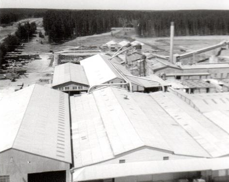
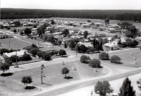
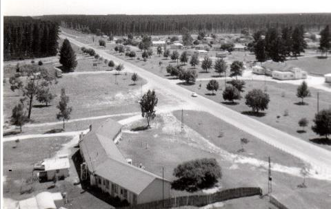
1967 photos supplied by Michael Bleby

Back to South Australian Towers
Back to Home Page