Current: 24m
Current: steel
Current: ?m -
Current: 1961? -
|
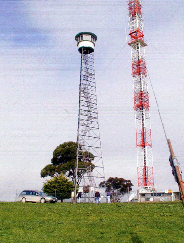
| Grid Reference | -37.601994, 140.482369 (GDA 94) | Department | ForestrySA | Work Centre | ? | District | Mt. Burr | Grading | ? | Elevation (ASL) | 230m | Height | Original: ?m Current: 24m | <
Construction | Original: timber Current: steel |
Cabin size | Original: ?m Current: ?m - |
Public access to site | ? | In use since | Original: 1928 - 19?? Current: 1961? - |
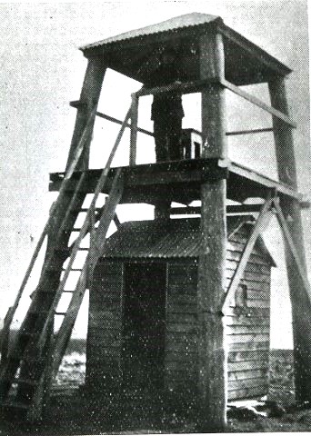 |
This 1928 photo is Copyright ForestrySA and provided by the City of Mount Gambier Library in March 2022 and used with permission. For the City of Mount Gambier Library's website page with the collection of fire tower photos, please click here. On this page, you can click on the individual photo for detailed description. |