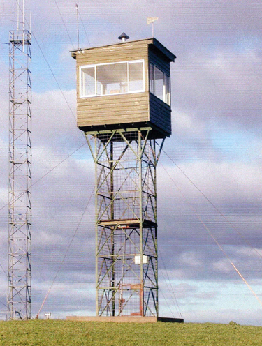
BLUFF


Grid Reference -37.726150, 140.571247 (GDA 94)
Department ForestrySA
Work Centre ?
District Tantanoola
Grading ?
Elevation (ASL) 200m
Height 6m
Construction Steel
Cabin size ?
Public access to site ?
In use since 1958 -
Photo and information supplied by Dennis R. Page, via Alison McLeod

Please click on thumbnails for enlargements

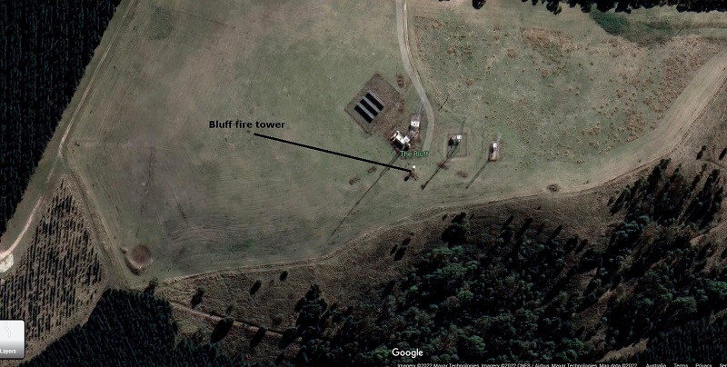
Bluff on Google Maps


At the start of the 2020-21 fire season, the FLO was made redundant and replaced by a FireHawk camera. Please click here for a link to the article. The camera has been installed on the Bluff communication tower.

Below is an extract from the Fire Tower chapter of a book, Forestry Tales, that was written by Michael H. Bleby OAM. It is used with permission, thanks Michael.
The most southern tower in the District was a relatively low tower in an open paddock on top of the Bluff south of Glencoe. It was clearly visible by travellers on the Princes Highway, and it had a very limited view to the North but a clear vista to the south and to the east. Mt Gambier was clearly in view, as were areas across to the Victorian border and land to the south west and the coastal Kongorong plantations. A smoke to the North would have to get up to a fairly high altitude before the observer at the Bluff would see it. A fire would often have to be going for some time for this to happen, nevertheless the Bluff was of most use for early detection from bearings through 90 to 270 degrees.


Back to South Australian Towers
Back to Home Page